Search:
«TRITON»-BASED UNDERWATER AND WELL MAGNETOMETER-GRADIOMETER
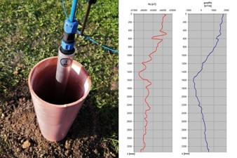
Magnetic measurements on 40 meters under water and more with up to 0.1 nT resolution
Application:
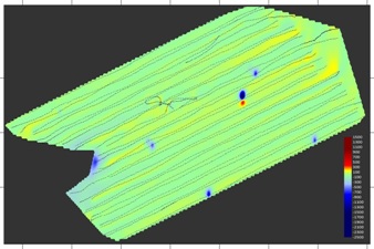
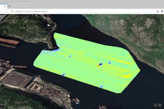
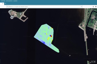
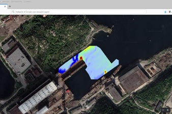
- Automated real-time survey and magnetic field mapping
of geomagnetic anomalies on the land and in the sea;
- Geophysical well logging, real-time inspection and telemetry
of drilled or used oil and gas wells, mines and boreholes;
- Underwater archeology and geohysics.
Key features:
- High resolution from 1.0 nT to 0.1 nT (optionally);
- Wide ±70 000 nT or ±180 000 nT (optionally) measurement range;
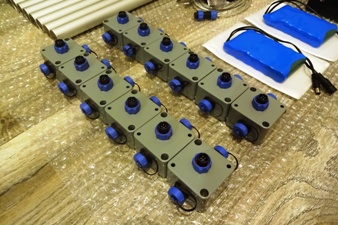
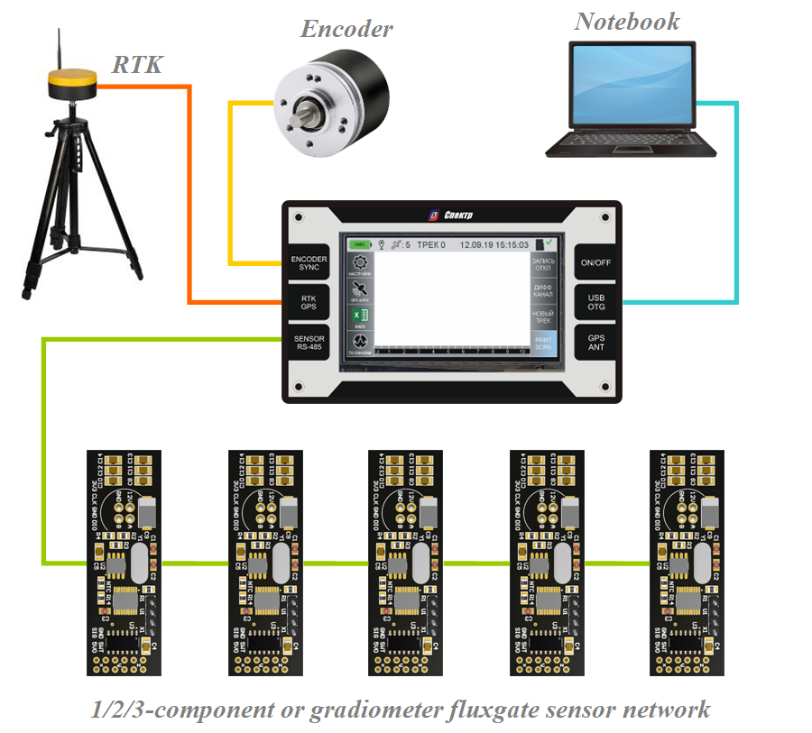
- Up to 12x 3-component sensors can be used simultaneously;
- Sensors networking at distances up to 2 km and more;
- Can be integrated with ROV and optionally equipped by special channel
to transfer measured data in real time to the ROV controller on the ship;
- Anyone topology of magnetic field sensor can be chosen from
single fluxgate element to gradiometer or 3-component topology;
- Making possible to provide magnetic measurements down to 1 km under water;
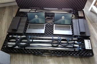
- USB/RS-232 interface to connect custom GNSS receiver, or RTK system,
or sea radar (e.g. Trimble R8, Emlid Reach RS+, Lowrance Elite-7 Ti, etc.);
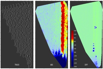
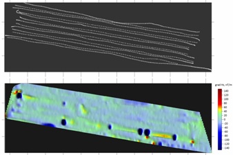
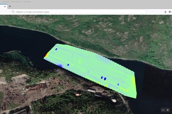
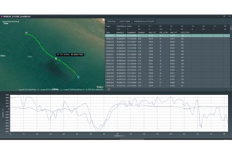
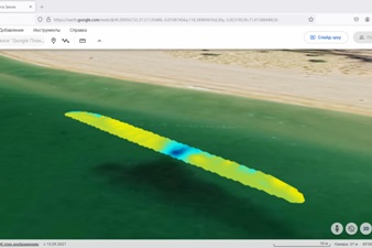
- Real-time color map, linear graph and digital indication of measurements;
- Being connected to the personal computer the Triton system works
like a standard USB flash drive, does not require any software driver;
- Output data format compatible with Surfer and Google Earth.
System architecture:
Magnetic field measurement system | |
| Magnetic field sensitive element: | fluxgate, straight |
| Magnetic field sensor topologies provided by default: | 1/2/3-component or gradiometer |
| Amount of 1/2/3-component or gradiometer magnetic field sensor maintained by system simultaneously: |
1 – 12 or more (on special request) |
| Magnetic field components measurement range, nT: | ±70000 or ±180000 |
| Magnetic field gradient components measurement range, nT/m: | ±140000 or ±360000 |
| Magnetic field sensing resolution, nT: | 1.0 or 0.1 |
| Measurement data rate setting 3-component samples per second: |
0.001 – 500 |
| Maximum length of acquisition-to-sensor cable, m (depended on customer’s requirements): |
2000 |
Coordinates measurement system | |
| Measurement synchronization sources: | built-in timer external odometer |
|
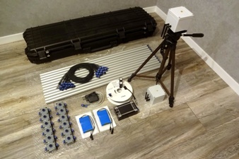
Coordinates measurement units: – built-in GNSS receiver – odometer on the base of incremental encoder – RTK system consists of receiver and base station |
standard option option |
| RTK navigation systems supported: | GPS, GLONASS, GALILEO, BEIDOU |
| RTK base station coverage radius, km: | up to 40 |
| External receiver connection (for third part manufacturers): | USB/RS-232 NMEA 0183 protocol 115200bps/8/1/no parity |
|
Typical plane position measurement error, m:
– built-in receiver – RTK system |
±10 ±0,02 |
Storing and transferring data measured | |
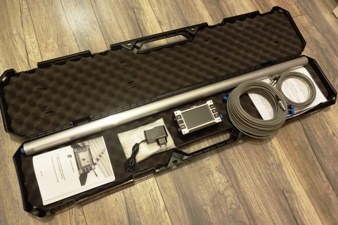
| Capacity of memory to save data measured: | 8GB – 64GB (optional) |
| Personal computer communication: | USB port |
Mechanical specs and power supply | |
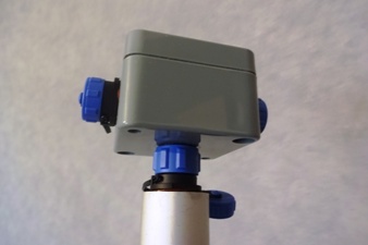
| Data acquisition unit dimensions (length × width × height, mm): |
151×90×54 |
|
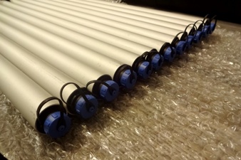
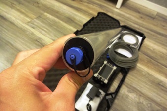
Magnetic field sensors dimensions (length × width × height, mm):
– gradiometer – 3-component |
1020×60×30 120×100×90 |
| Magnetic field sensors water resistance, m: | 40 |
|
RTK system components dimensions (length × width × height, mm): – receiver – base station (without tripod) – tripod for RTK base station – tripod when folded |
120×65×55 170×85×55 1450×600×800 550×100×100 |
| Data acquisition unit weight, g: | 540 |
|
Magnetic field sensors weight, g:
– gradiometer – 3-component |
420 300 |
|
RTK system components weight, g:
– receiver – base station (without tripod) – tripod for RTK base station |
230 1300 1200 |
| Power supply source: | lithium accumulator battery 3S2P |
| Supply current from fully-charged accumulator, mA: | 800 |
| Working temperature range, °С: | –20…+70 |

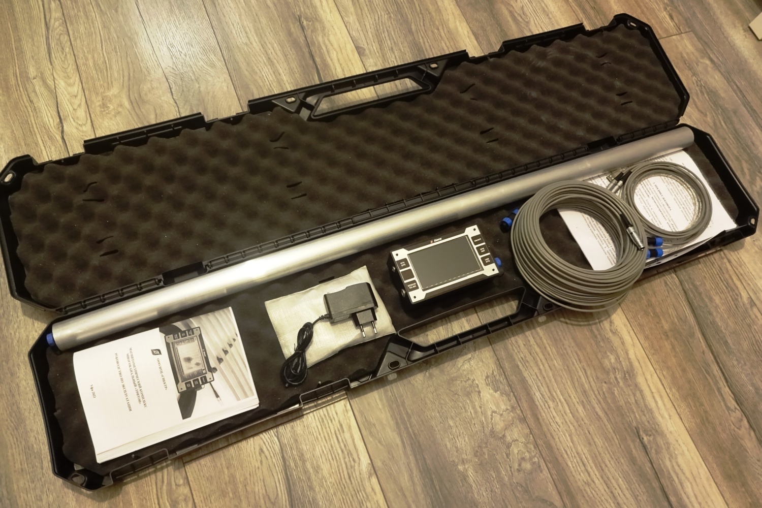
«Triton» multichannel magnetic field measurement system. User manual
Size of file: 37,2 MB
«TritonGRAD» application software and sample data included
Size of file: 23,8 MB
Download Surfer Software from official website
https://www.goldensoftware.com/products/surfer
Go to Google Earth online service
https://www.google.com/earth/